OSKAR has made the archipelago safer, but has not improved public transport
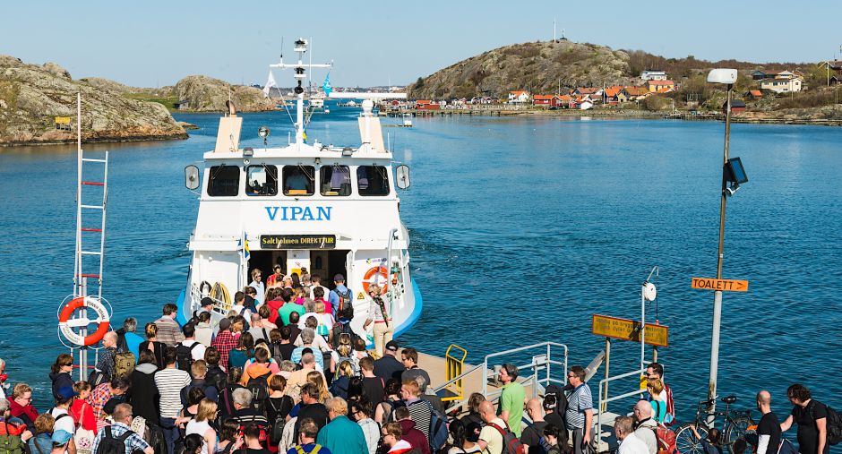
In the OSKAR project, funded by the Swedish Transport Administration, 20 square kilometers in the southern archipelago of Gothenburg have been surveyed. This has improved maritime safety but has not optimized the waterborne public transport as intended. This was impossible because data from previous archipelago traffic was not made available.
The OSKAR project, which started in June 2020, stands for "Optimization of Waterborne Public Transport and Other Regular Traffic." As the name suggests, it has been about developing routes in the archipelago.
"The project is a spin-off from a previous project, ADAPT, where we looked at how to optimize public transport routes in the Stockholm archipelago. We conducted surveys and collaborated with, among others, Waxholmsbolaget, which operated the public transport and provided detailed information, such as their passenger flows. The idea with the OSKAR project was to use such data to develop more powerful models that can be used in advance to see where the needs are greatest before starting a survey. Surveying is an expensive process, and in this way, we could ensure that it is done where it is socio-economically profitable," says Linda Blied from the Swedish Maritime Administration, who led the project in collaboration with Linköping University and VTI.
In the project, which had a budget of 10.7 million SEK, a model for surveying has also been developed that can estimate depth based on AIS data and the existing depth data available. However, it has not been as successful in using it to optimize routes and departures for public transport in the Gothenburg archipelago.
"We had somewhat taken for granted that we would also receive the same detailed information on the West Coast as we did from Waxholmsbolaget, but it has not been available. So we have built a model that unfortunately could not be verified because there is no input data. Hopefully, this will be possible in the future."
Despite not being able to say anything about how to optimize public transport in the Gothenburg archipelago, the project has still provided quite a lot, according to Linda Blied.
"Firstly, the surveys conducted over an area of about 20 square kilometers are something concrete that will be included in the nautical charts. Additionally, we identified five places where the safety risk was so significant that the survey results were immediately published in a so-called Ufs notice (Notices to Mariners). We also found places with both greater and lesser depths than previously known. Above all, we hope that our survey data from the shallow strait between Asperö and Köpstadsö can influence the planning of public transport routes in the future. Today, vessels mainly go around the strait, but according to our preliminary results, the vessels used today, which have a slightly shallower draft, should be able to go through there."
Another concrete benefit of the project has been the testing of the new autonomous survey unit, Skräddaren, which is primarily intended for shallow waters up to 3 meters deep. Previously, it has not been possible to survey the shallow Asperö Strait between Brännö and Asperö, which is used by local mariners with good local knowledge.
"It turned out to be far too shallow to operate ferries there," says Linda Blied.
-
 Ny studie: Eldrivna pendelbåtar kan effektivisera Stockholms kollektivtrafik
 -
 EU: Sjöfartens utsläpp ökar
 -
 Sociala relationer påverkar val av bränsle
 -
 Sjöfartens omställning kräver ”mjukare” påtryckningar
 -
 Hon hade avtalad tid med Kapten ynkrygg
 -
 Lighthouse omvärldsanalys 2025 – osäkerhet och tullar präglar sjöfarten
 -
 Se seminariet Shipping in the Marine Environment
 -
 Vad betyder egentligen de 90 procenten?
 -
 Hålla där...
 -
 Ny rapport: Klimatförändringarna ett hot mot de flesta större hamnar i världen

