")
")
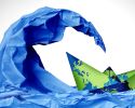
Sharing radar data can make icebreaking more efficient

Sharing radar data between ships and icebreakers can reduce fuel consumption, improve coordination, and increase the availability of icebreaker assistance. Better time-series studies of ice can also reduce the need for assistance. This is shown by new research funded by the Swedish Transport Administration.
How can icebreaking be made more efficient? By combining two research areas. One area focuses on identifying how ice moves, where Chalmers' research maps ice drift with radar data to predict ice pressure and locate where ice ridges and leads are likely to form.
"The other area focuses on whether it’s possible to combine data from different sources. We wanted to test if radar data from ships could be linked with satellite data and if icebreakers in the same area could share their radar data. This would allow for a common, real-time updated situational awareness of the ice conditions. As it is today, one gets a satellite image per day and then tries to predict the movement of ice based on wind and currents", says Joakim Lundman, project manager at RISE and one of the authors of the feasibility study report Ice Navigation supported by Crowd-Sourced Radar Data.
He himself gained valuable insight into how icebreaking works when he spent four weeks onboard the icebreaker Ymer during the 2023/2024 ice season – one of the more difficult ones in recent years.
"I saw how the work operated onboard and was able to ask about what information was most valuable and whether our ideas seemed relevant. Even though they hadn’t thought along those lines before, they agreed – especially, they requested more frequent updates of the satellite images."
The researchers conducted tests with ship radar in the Gothenburg area, where they had access to generated radar data that could be combined with satellite images – though without sea ice.
"The tests showed that the concept can work. The challenge isn’t so much the technology, but the practical obstacles – especially gaining access to data. Manufacturers often lock their systems, making it difficult to combine data from different sources. Additionally, it is important to ensure cybersecurity and resilient connections so that the information is reliable."
Today's systems give the impression that the ice moves as a homogeneous block, but in reality, different parts of the ice move at different speeds. By combining radar data from icebreakers with satellite images, situational awareness can be created.
"This would make icebreaking more efficient. For example, ships in convoy can be released earlier if the ice conditions to the next icebreaker are favorable. Instead of being escorted all the way, ships could proceed on their own where it is safe. This saves both time and fuel", says Joakim Lundman.
The new technology could also reduce the number of ships that get stuck in the ice, which in turn would reduce the need for assistance. According to the report, this leads to lower investment and operational costs and facilitates the recruitment of specialized personnel for ice navigation.
The report Ice Navigation supported by Crowd-Sourced Radar Data was written by Joakim Lundman (RISE Maritime Department), Ted Sjöblom (RISE Maritime Department), and Leif Eriksson (Chalmers, Department of Space, Earth and Environmental Sciences).
Image: Swedish Maritime Administration
-
 Därför väljer rederierna bort gröna bränslen
 -
 Trafikverket sammanfattar reaktionerna på minskade forskningsanslag
 -
 Betalningsviljan för gröna sjötransporter sjunker
 -
 Affärsmodeller för hamnar kopplat till havsbaserad vindkraft har utvecklats
 -
 Sjöfarten digitaliseras, men sjöfolkets kunskap är analog
 -
 Se Lighthouse Almedalsseminarium om de minskade forskningsanslagens konsekvenser
 -
 Ny studie: Internet och bra sömn viktigast ombord
 -
 HELP ska hjälpa hamnar att klara elomställningen
 -
 Vindkraftsparker och vintersjöfarten krockar i Bottenviken
 -
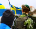 Totalförsvarsövning funkade bra, men kan göras bättre


